The above pictured map of Johannes Wild was made between 1843 and 1851 and reflects the entire region of the Canton of Zurich on a scale of 1:25.000. Wild only coloured the forests within the Canton of Zurich and left the surrounding areas in a draft.
Well visible on the map is the railway line of the St. Gallen - Appenzell Railway Company. The line went live on 14 October, 1855 and was originally planed to pass through Ettenhausen over the Blankenmoos to Elgg.
At the time Ettenhausen was reduced to the Oberdorf. The Unterdorf was added later during the second half of the 19th century.
More or less at the same time in 1848, the former monastery of Tänikon was confiscated by the Canton of Thurgau and later sold to a well known family called von Planta.
View on today's Iltishausen. With the exception of Amrein's farm, built in 1865, Iltishausen did practically not change since the Middle Age. Easy to identify is the Oberhof and Unterhof of Iltishausen established in 1459 and 1578 respectively.
The family history of the Aadorfer Zehnder is trackable back to the year of 1459 and back to this unchanged place in the hinterland of the Canton of Thurgau.
Every thing which was before those times, still remains in secrets.
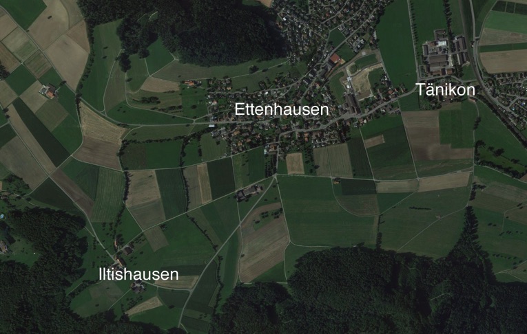
3. Aerial photo of the area of Iltishausen, Ettenhausen and Tänikon
The airplane view shows how Ettenhausen developed over the last 160 years. Today, Ettenhausen and Aadorf are not only merged politically but also geographically. Tänikon has grown as well, but is still surrounded by green areas and clearly separated from Ettenhausen and Guntershausen.
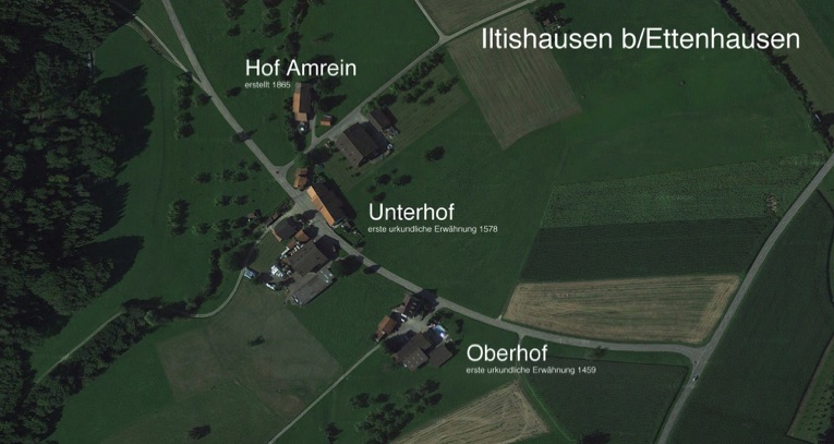
3. Focused aerial view of today's Iltishausen
The Zehnder family tree is very extensive and goes back to the 17th century.
Access to the family tree is restricted.
Anyone who can show a credible relationship to the family tree can request access to the family tree via "contact".